
Portage ZIP Code Directory Coverage
Official sources support two ordinary Portage delivery ZIPs, 49002 and 49024. USPS FAST material also associates 49081 with the Portage name, but the official public source reviewed did not show its exact use or classification. That distinction matters. A postal directory can describe the evidence found for Portage without guessing a street-by-street boundary or treating a name association as a delivery guarantee.
The USPS postal lookup is the first check for a full address. Michigan's mapping material warns that ZIP boundaries are approximate, do not coincide with Census ZCTAs, and should be confirmed with USPS. The county street directory gives useful address-range examples, but it is not a complete delivery-boundary table. Use a live address result whenever a mailing label affects a Portage record search.
| ZIP | Documented Portage connection | Postal reference | Research caution |
|---|---|---|---|
| 49002 | Standard Portage-area delivery ZIP in USPS and Michigan material; Portage District Library uses it. | Portage administrative office label after the 2012 change. | Exact neighborhood and parcel boundaries were not located. |
| 49024 | Standard Portage-area delivery ZIP; county street examples include Portage City addresses. | Portage Post Office label; station address uses 49024-9998. | Do not convert a delivery area into a legal city boundary. |
| 49081 | Portage-associated listing in USPS FAST material. | Live USPS result required for exact category or use. | Its public classification was not verified, so it is not assumed to be a standard route. |
The City of Portage's charter boundary follows the 1963 Portage Township footprint plus later annexations and detachments. Postal coverage has a different purpose. An address can therefore carry a Portage delivery label while a municipal or historical record uses another jurisdictional description.
USPS Fields for a Portage ZIP
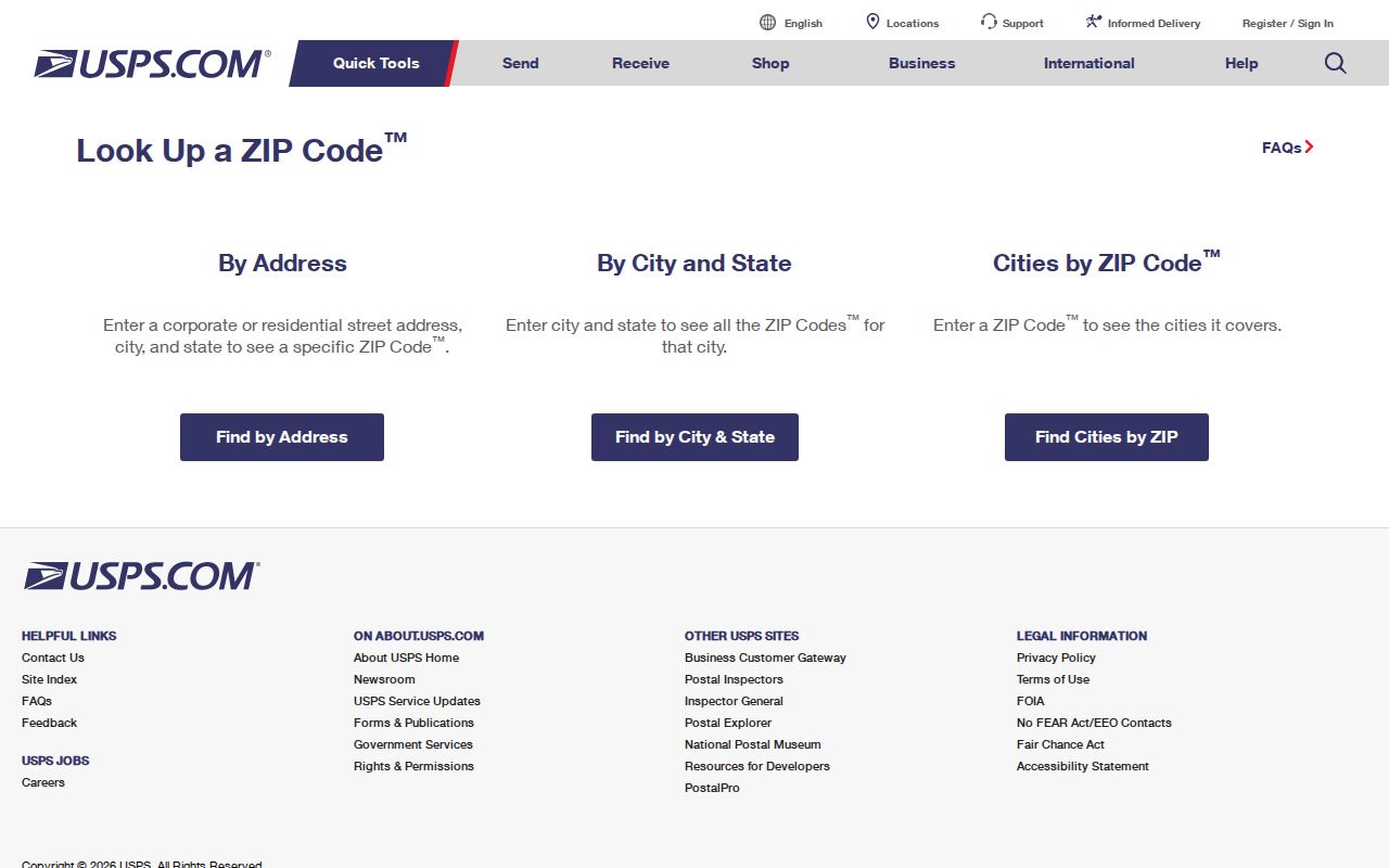
USPS exposes three separate search modes. By Address is the best mode for checking one complete mailing address. By City and State returns ZIP information for a place name, and Cities by ZIP reverses that relationship. Each mode asks for a different minimum set of fields. A successful result establishes postal routing information, not who receives mail at the address.
The supplied USPS lookup capture shows the official Portage ZIP search interface. Enter the field set for the chosen mode, then retain the result beside the source that supplied the address.
Checking the entire street address produces a more useful postal result than relying on a city label alone. The result can then help normalize an address for a parcel, court, historical-directory, or records request. It should never become a substitute for confirmation from the record custodian.
| USPS mode | Field | Required | Format or use |
|---|---|---|---|
| By Address | Company | No | Optional addressee detail. |
| By Address | Street Address | Yes | The core physical delivery address. |
| By Address | Apt/Suite/Other | No | Optional unit detail when applicable. |
| By Address | City and State | Yes | Required locality fields. |
| By Address | ZIP | No | Useful when checking an expected ZIP against the address. |
| By City and State | City and State | Yes | Finds postal ZIP information for that place input. |
| Cities by ZIP | ZIP | Yes | Returns cities associated with the entered ZIP. |
Portage Postal Labels
Older records can use Kalamazoo where a newer postal label uses Portage. USPS Postal Bulletin 22342 records a 2012 administrative change for 49002 and 49024 from Kalamazoo to Portage. That is an office-label change, not evidence that every historical document should be rewritten. A directory entry, deed, obituary, or address card retains the postal convention used when it was created.
Search both city labels when a historical Portage address is difficult to find. The city itself was incorporated in 1963 from the Portage Township footprint with later boundary changes, so a record may also carry Portage Township or a neighboring place name. Pair the historical label with a street, year, and jurisdiction. This keeps a postal transition from hiding a valid local record.
The 2020 Kalamazoo County Street Name Directory supplies useful range and municipality context. Its examples include Beacon Harbor and Bealwood in Portage City with 49024, Portside in Austin View with 49002, and Portage Industrial Drive with 49024. Those examples are a reality check for one street, not a complete Portage ZIP inventory.
Finding Residents in a Portage ZIP
Use a ZIP to organize an address search, not to identify a person. Start with the full address in USPS, then use the address in the official Portage or Kalamazoo County record that matches the question. The City of Portage GIS accepts owner name, address, plat, intersection, and parcel number. Its parcels and boundaries are approximate, but the tool can give current parcel context, aerial imagery, and overlays such as voter precincts, school districts, zoning, floodplains, wetlands, and future land use.
- Run the complete address through USPS By Address and record the returned postal information.
- Use the same address in Portage GIS for parcel and map context, keeping the address separate from the identity of any person.
- Use the needed official source, such as property records, a court clerk, a historical directory, or the city clerk, rather than expecting a ZIP filter to supply a resident list.
- Compare two independent sources before treating a name connection as reliable, and preserve the source date and jurisdiction.
Portage Property & Tax Lookup is updated daily, while city sources say some supporting documents need a focused FOIA request. The county parcel search has Owner, Parcel ID, and Street tabs, but the captured modes do not include a ZIP field. Once a delivery area has been narrowed to a street, the Portage street directory is the better route for address-by-address context.
Portage Postal Record Filters
No local ZIP filter was captured for the Portage GIS, Portage BS&A property search, or the Kalamazoo County parcel search. The county's documented parcel modes are Owner, Parcel ID, and Street. Portage GIS documents address, owner, plat, intersection, and parcel-number searches. That is an important limit: a postal directory should not imply that the city or county publishes a ZIP-wide resident output when the inspected tools do not show that control.
There are still several access channels for work that begins with a postal result. The city property route can supply current parcel context. City GIS can inspect one address and nearby mapping layers. The County Street Name Directory can check a range and municipality reference. For a historic address or document absent from the web, Portage's FOIA route can be used for a sufficiently described city-held record, while court records and county deeds use their own custodians and procedures. A library or archive may be needed for old directories, maps, or local clippings.
Michigan voter records have a different role. MVIC searches official voter information by first name, last name, birth month, and birth year, and state registration-file records have protected fields. The research did not capture a ZIP input for MVIC. A voter record may help with election administration information, but it does not prove current presence at a parcel. Note: Use an address and a date to search the right system, not a postal label as a substitute for identity.
Portage ZIP Code Directory Boundaries
A delivery ZIP is a postal geography. It is not a surveyed city edge, tax boundary, parcel line, voting precinct, or Census ZCTA. Michigan's DTMB map explicitly treats ZIP boundaries as approximate and directs delivery questions to USPS. The map visually places 49002 and 49024 around Portage and Kalamazoo, but it cannot establish the postal status of one parcel or the municipal status of a street.
- ZIP and ZIP+4
- A five-digit ZIP directs mail to a broad delivery area. ZIP+4 adds a more specific delivery segment; neither is proof of residence.
- PO-box ZIP
- A postal ZIP used for post-office boxes. Its association with a city name does not show that it serves ordinary street delivery.
- Unique ZIP
- A postal designation assigned to a single organization or large recipient. No Portage unique ZIP was verified in the sources reviewed.
- Carrier route
- A postal delivery grouping used to organize mail movement. It is not a municipal boundary or resident roster.
The Portage Post Office at 1151 W. Milham Avenue uses 49024-9998. Its own ZIP+4 is a practical USPS anchor, but it does not show that all nearby addresses use 49024. Check the actual address instead. That simple step avoids broad boundary claims unsupported by the available sources.
Portage City Limits and ZIP Codes
Portage's legal footprint and its delivery geography overlap without matching. The city charter uses the organized Portage Township as it existed in 1963, then allows later annexations and detachments. USPS delivery areas answer a different operational question. A record can therefore be connected to Portage by postal label, city jurisdiction, township history, county record location, or more than one of those descriptions.
This local mismatch is especially important for family history and property research. Historic material may use Kalamazoo, Portage Township, or Portage, while a current USPS result may use a Portage label. Keep the original form in notes and state the source. When a record depends on a city limit, confirm it through the city, county, or other responsible government custodian rather than a postal map.
ZIP Code Results Need Confirmation
USPS states that a ZIP lookup does not confirm that an individual or company receives mail at an address. It also does not confirm a person's identity, current residence, ownership, court history, or voter status. A postal result is a useful address-normalization step. The independent record, and not the ZIP, must establish the fact being checked.
Use postal results carefully. Keep ZIP research focused on an address or delivery question. Do not use it to assemble sensitive details, infer protected information, or stalk, harass, intimidate, or harm any person.
For an uncertain 49081 result, use the live USPS form rather than assuming its category from a city label. For a source that appears wrong, contact the custodian of that source: USPS for delivery information, the City of Portage for city-held material, Kalamazoo County for county records, and the appropriate court or state office for its own file.